Kybos Site Atlas

Every lot. Every stage. One interactive 3D map.

Site Atlas turns a 3D capture of your site into a map anyone can open in a browser. Click a lot, a home or an apartment to see its listing, its build stage, its plans and its photos. Capture it again and see what changed.

Playing: King Forest Demo · land estate · 69 lots

01 · The idea

Point at a lot.
It lifts out of the site.

That is the whole idea. Your site, as it really looks, with every lot carrying its own information. Try it on the drawing below: move over a lot, or tap one.

    Drawing for illustration. The real thing is your own capture.

    02 · Live sites

    Three live sites. Open them.

    A land estate, a property and a 25-storey tower. Each one is a live Atlas site. They open with the same password that let you in here. Best on Wi-Fi, because they are large 3D scenes.

    Land estate

    King Forest Demo

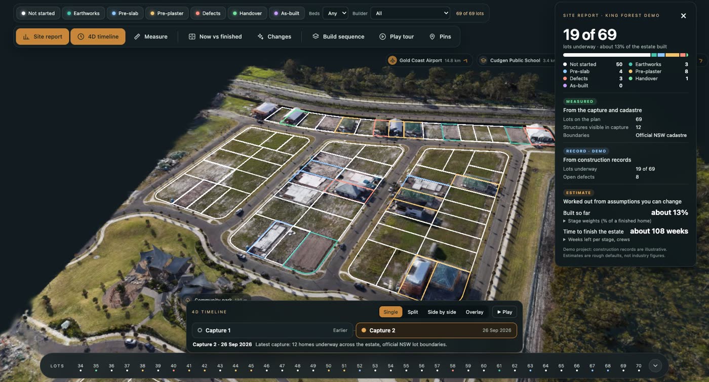
    A 69-lot estate, captured by drone on two dates. Every lot is outlined on the ground and coloured by its build stage.

    • Site report: lots underway and how much of the estate is built
    • 4D timeline: compare the two capture dates
    • Official NSW lot boundaries
    Open King Forest →

    The capture is real. Its construction records are examples.
    Real estate

    Ridgeview

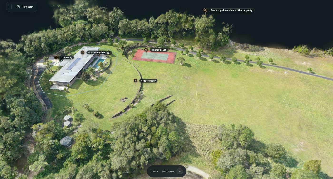
    A rural property, shown the way a buyer wants to see it. They can explore the whole place before the first visit.

    • Pins open 3D tours of the home, the pool and the tennis court
    • A video teaser and photos, opened from the map
    • Play tour flies a visitor around the property
    Open Ridgeview →

    High-rise development

    A 25-storey apartment tower

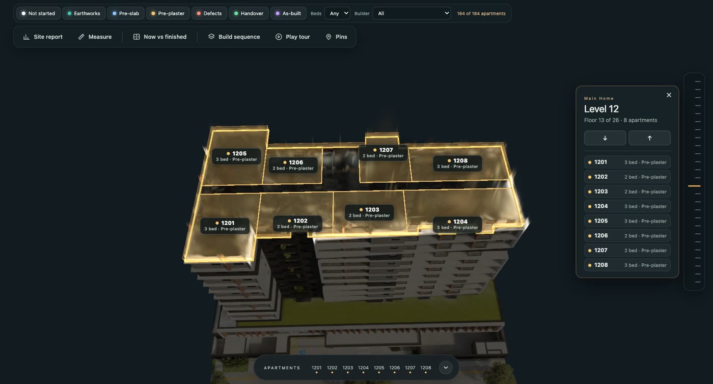
    Broadbeach demo: 184 apartments across 25 levels. Pick a level and the building opens at that floor.

    • Every apartment on the level outlined, named and showing its build stage
    • Filter by stage, bedrooms or builder
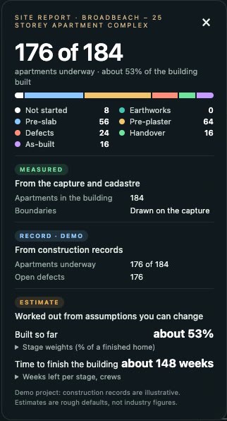
    • Site report: apartments underway, open defects and how much is built
    Open the tower →

    Demo project. Its apartment records are examples.

    03 · What it does

    Everything about the site, where it actually is.

    4D timeline

    See what changed between two dates.

    Capture the site again and both dates sit in the same place. Compare them four ways.

    Boundaries

    Official lots, laid on the capture.

    Lot boundaries come from the official NSW and QLD records, or from your own plan, and sit on the ground where they belong.

    Pins

    Photos, video and 3D tours at the exact spot.

    Drop a pin on the pool, the kitchen or the entrance. Visitors click it and step inside. Play tour flies them around every stop.

    Files

    Plans and documents, filed by lot and stage.

    Plans, photos, brochures and reports open from the lot they belong to. No more hunting through shared folders.

    Measure

    Distances in real metres.

    Click two points on the capture and read the distance between them.

    Levels

    Open a tower floor by floor.

    Pick a level and the building opens there, with each apartment outlined, named and showing its stage.

    Sharing

    Private until you say otherwise.

    Each project has one link and three settings. You choose.

    Enquiries

    Interest goes straight to your inbox.

    A visitor looking at a lot can register interest or request a report from that lot's card. The message arrives by email, naming the lot they were looking at.

    04 · Who it's for

    One site. Shown the way each audience needs it.

    A buyer and a site manager look at the same ground and want different things. Each kind of Atlas site shows only what its audience needs.

    Real estate

    Estates, homes, apartments

    • Lots coloured by sales status
    • A listing on every lot
    • 3D walkthroughs and floor plans
    • Sales summary of the whole release
    See Ridgeview →

    Construction

    Estates and high-rise

    • Lots and apartments coloured by build stage
    • Towers opened level by level
    • Stage timeline, defects and plans on each
    • Compare captures over time
    See the tower →

    Asset management

    Finished buildings

    • Buildings coloured by condition
    • Open issues on each one
    • Inspections that are due
    • A condition report for the site

    Showcase

    Venues, retreats, resorts

    • Places to explore, each with a story
    • Photos, video and 3D tours
    • A guided flight around the property
    • One button: Enquire or Book a stay

    05 · How it works

    From a capture to a link you can send.

    1. 1

      We capture the site

      A drone flight for the whole site. A 3D walkthrough or a laser scan for the insides, where you need them.

    2. 2

      We build your Atlas

      Lots are outlined on the capture. Send a spreadsheet of lots and a folder of plans and photos, and they are filed where they belong.

    3. 3

      You get one link

      It opens in any browser, on a computer or a phone. It stays private until you choose a password or open it to everyone.

    4. 4

      Capture it again

      Each new capture is lined up with the first and added to the timeline, so the site's history builds up in one place.

    06 · Questions

    Plain answers.

    Do visitors need to install anything?+

    No. An Atlas site is a web page. It opens from a link in the browser people already have, on a computer, a tablet or a phone.

    Who can see my site?+

    Only who you decide. Every project starts switched off. You can then give it a password to share with your team or your client, or open it to anyone who has the link. You can change this at any time.

    Is this a survey?+

    No. Site Atlas is spatial documentation, not a certified survey. It shows the site as it was on the day of the capture, and it is a record you can look at, measure on and share. It does not replace a registered surveyor.

    What do you need from me?+

    The address of the site and access to capture it. If you have them: a list of lots (a spreadsheet is fine), and any plans, photos or brochures you want attached. For a single property, a map link and the property's web page are enough to start.

    Where do the lot boundaries come from?+

    In New South Wales and Queensland, from the official land records. Anywhere else, or for stages not yet registered, from your own plan, laid over the capture and matched to it.

    What does it cost?+

    It depends on the size of the site and how often it is captured. Tell us about the site and we will send a quote.

    Next step

    See your own site in Atlas.

    Twenty minutes, on a call. We open the live sites together, you tell us about your site, and we tell you plainly whether Atlas fits.

    Or write to info@kybos.au